YouTube playlist Available now
Spatial Data Science Webinar Series
Recorded talks on geospatial data analysis for ecological research, with worked examples drawn from the upper East River watershed.
Watch on YouTubeOpen data platforms, software libraries, forecasting tools, and live monitoring services for long-term ecological research at Rocky Mountain Biological Laboratory and beyond.
Tools for discovering a century of RMBL environmental knowledge and data.
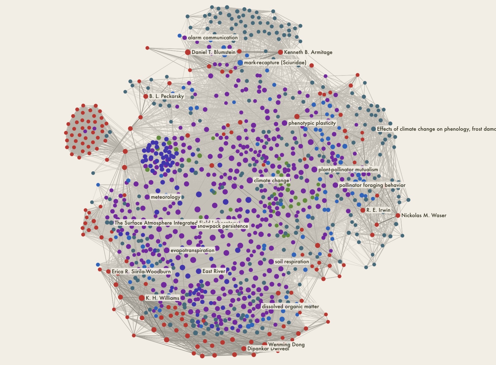
A knowledge graph linking 5,000 publications and 1,200 datasets from the Gunnison Basin. Search by keyword or concept, trace connections between species, sites, and researchers, or query the corpus through Claude and other AI assistants via MCP.
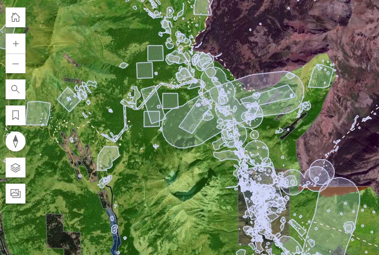
Explore RMBL geospatial data in the browser. Pan, zoom, and pull values from any layer — no code required.
Geolocation and GIS services using our ArcGIS Online platform.
An interactive map of RMBL research sites in relation to wilderness areas, roads and trails, and private property — useful for planning site visits.
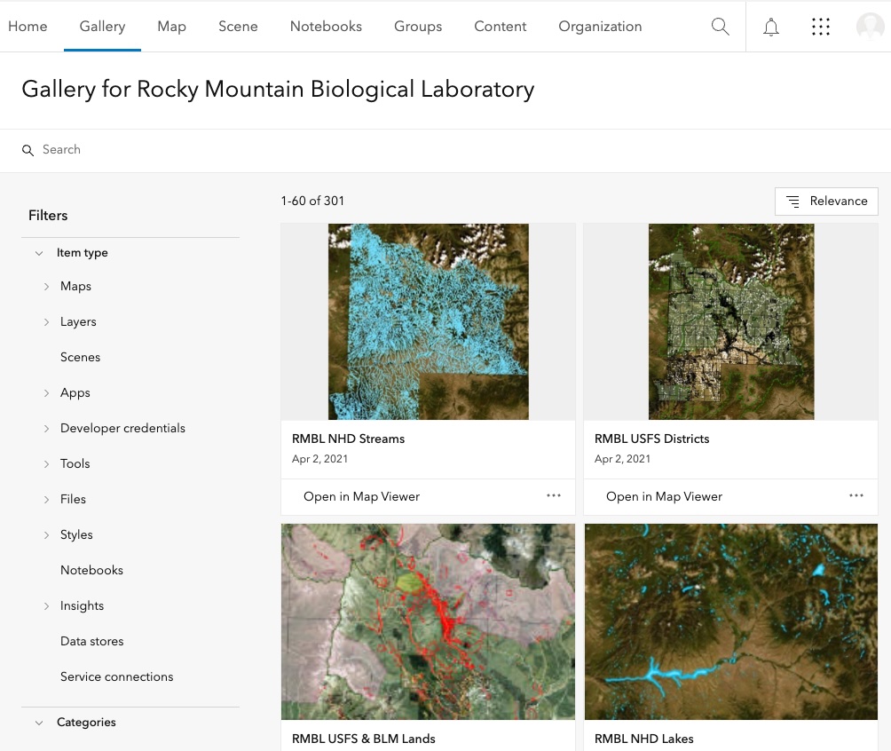
RMBL's ArcGIS Online organization. Browse hosted maps, layers, and apps for research sites across the upper East River watershed.
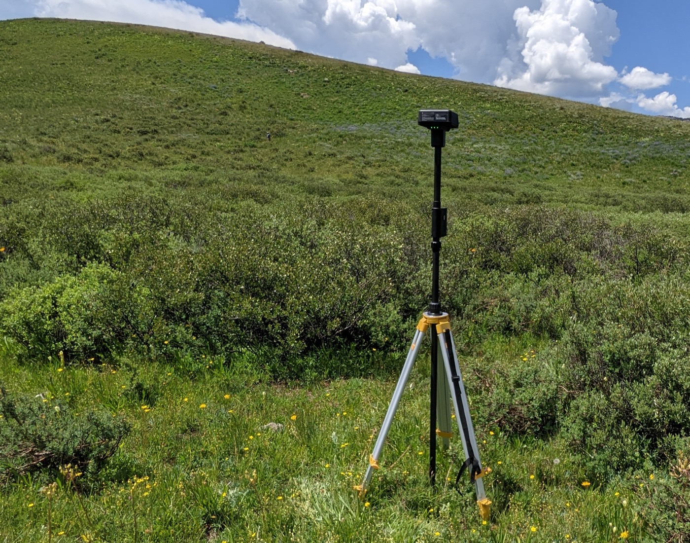
Guidance and contacts for GPS data collection, GIS support, and site mapping for fieldwork at RMBL.
Near-real-time readings from the RMBL sensor network and a live webcam over the townsite.
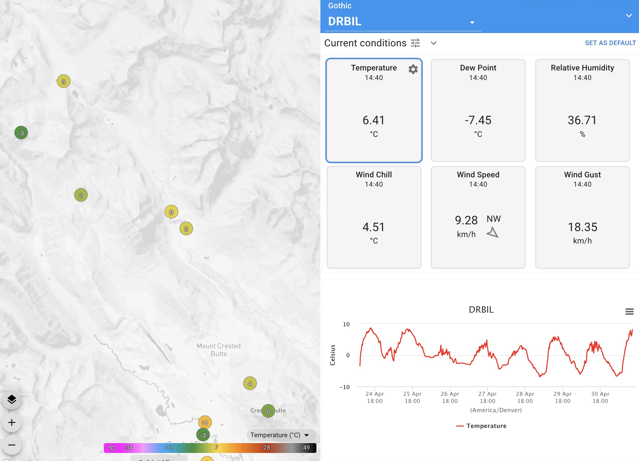
Live-updating measurements from Gothic and nearby, with access to historical weather and snow data.
A live look up the valley from Gothic, hosted by long-time resident billy barr, who has tracked weather and snowpack from this site since 1972.

Daily snowfall, snow depth, and weather observations from Gothic — a long-running record hand-kept by billy barr since the 1970s.
R and Python clients for the Spatial Data Platform, and a shared JupyterHub with the data already mounted. For people writing the code that becomes the science.

A native Python client for the Spatial Data Platform. Lazy cloud reads with xarray, geopandas, and rasterio.

An R package for discovering and reading SDP rasters and tabular data. Works directly against cloud storage with terra and sf.

A shared JupyterHub on AWS, preloaded with RMBL geospatial data and the rSDP and pySDP clients. Open RStudio or JupyterLab in a browser; access 6 TB of imagery and rasters directly.
Tools that combine the long-term record with current-year observations to forecast the season ahead. Aimed at researchers, land managers, and the public.
Recorded webinars, live workshops, and method walkthroughs from the people building these tools.
Recorded talks on geospatial data analysis for ecological research, with worked examples drawn from the upper East River watershed.
Watch on YouTubeHands-on sessions for the Spatial Data Platform, the Knowledge Hub, and the Compute Hub — from first install to a finished analysis.
Coming soonWalkthroughs of sensor deployment, drone survey design, and quality-control workflows for the high alpine.
Coming soonServices and partnerships for research groups, agencies, and institutions working at scale in the Gunnison Basin and beyond.
Drone imagery and topographic survey for the upper East River and adjacent watersheds, plus support for field instrumentation — sensor selection, deployment, and ongoing calibration in the high alpine.
Discuss a project →Help structuring datasets for long-term reuse: metadata standards, format migration, and deposit into the Spatial Data Platform or external domain repositories.
Discuss a project →Partner projects to turn raw observations into data products and mapping tools — from interpolated climate surfaces to species distribution models for the Gunnison Basin.
Discuss a project →A native Python client for the Spatial Data Platform — feature-complete with rSDP, with lazy reads via xarray, geopandas, and rasterio.
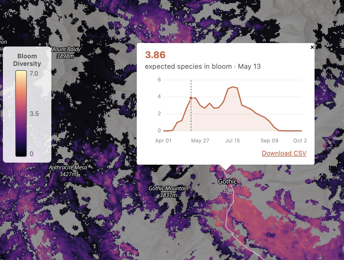
A weekly map of wildflower bloom probability for fourteen species across the upper East River watershed, built from long-term phenology records and current-year climate.
Hybrid keyword and semantic search across five decades of RMBL-affiliated science, plus 1,400 grey-literature documents and 1,200 datasets.
Rocky Mountain Biological Laboratory is an independent, non-profit field research station in Gothic, Colorado, founded in 1928. The tools on this page support some of the longest-running alpine-ecosystem studies in the world — pollinators, wildflowers, climate, snowpack, marmots, and the watershed itself.
The RMBL Data Hub, created with support from the Chrest Foundation and Clark Family Foundation, helps to accelerate research at RMBL and translate a century of environmental knowledge into actionable insights.
We build in the open. Source code lives on GitHub under rmbl-sdp; data flows through public APIs and cloud-hosted object stores; methods and limitations are documented alongside the code. If you use any of these tools in your work, we want to hear about it — Ian Breckheimer (ikb@rmbl.org).